IKAS evolution for inspection, analysis and documentation of sewer data
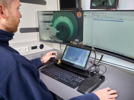
The software can be used on the inspection system and in the office.
- Optimal coordination: software and hardware from a single source
- The right tool for every job: The range of functions can be expanded easily and according to requirements
- Paperless data cycle: End-to-end digital workflows possible
- Optimized processes: Complex tasks are simplified through the targeted use of assistants
- Better basis for decision-making: Thanks to comprehensive surveying functions for qualified condition assessment
- Effective data analysis: Added-value information as a basis for rehabilitation planning
- Standard-compliant work: Recording, evaluation and dissemination in accordance with all current standards and regulations
- Fast data transfer: Simple configuration and transfer of inspection results with one click
The 360-degree all-round view in the canal and in the office
With IKAS evolution, the power of PANORAMO technology is optimally exploited throughout the entire process: from inspection in compliance with the rules at the point of use to analysis and evaluation of the recordings in the vehicle or office. Thanks to complete capture in ultra-high resolution 4K, a superior data basis is created for detecting even the finest cracks and leaks. This enables reliable damage classification and rehabilitation planning.
Profile measurement and profile analysis over the entire pipe length
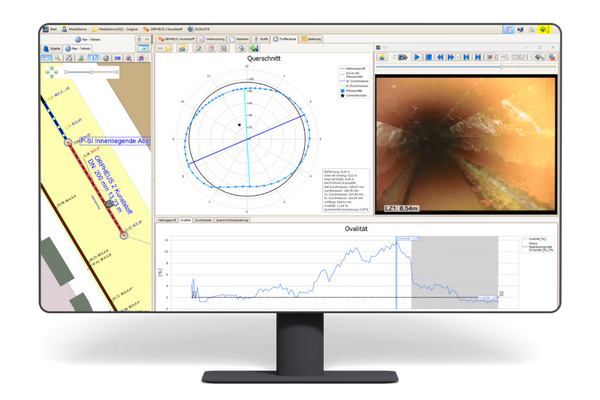
Dimensional deviations and smooth dimensional changes are not always visible to the naked eye during optical inspection. LaserScan deformation measurement records the real posture profile. With IKAS evolution, deviations in cross-section and ovality are displayed and evaluated.
Determine pipe routes exactly
In conjunction with suitable camera technology, the 3D sensor measurement data can be georeferenced during the inspection with IKAS evolution, stored and displayed in real time in a network graphic. The centimeter-accurate hydrostatic recording of the height measurement data is also supported. The operating procedures for course measurement are seamlessly integrated into the inspection operation of the IKAS evolution and enable precise course measurements in the same work step. The results can be exported in all common sewer data formats.
Digital documentation of inspection results
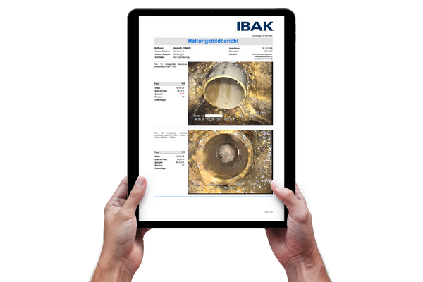
The results of the optical inspection are optimally processed in the interactive viewer and even complex conditions are clearly displayed. All necessary data (master, examination, classification, rehabilitation and measurement data) can be evaluated in addition to the inspection images and exported in the most important exchange formats for each individual customer.
| Uniform operating concept | The uniform and comprehensive program structure facilitates orientation and ensures fast and targeted operation. |
| Compliance with regulations | Data processing complies with all current standards and coding systems. The operator is supported by helpful assistants when entering the standard-compliant codes. |
| High data quality | Automatically executed plausibility checks validate the database and point out possible sources of error. |
| Data compatibility | Standardized interfaces make it easy to transfer data in all common exchange formats. |
| Meaningful reports | The documentation of the results can be prepared according to individual specifications in a clear and order-oriented manner. |
| Flexible storage space requirements | The data volume of the films can be adapted to job-specific requirements. |
| Future-proof investment | The software has a modular structure, so that the range of functions can be easily expanded as needed. |
| Optimal use of resources | Evaluation can be performed directly on site or in the office, as well as supported by artificial intelligence. |
| MAP Viewer | The integrated GIS viewer enables the graphical display of sewer networks, background plans and maps. In addition to GPS connection, the location display, main sewer and connection networks can be displayed three-dimensionally. |
| MAP Editor | Used for digitizing sewer network plans based on background maps and thus for creating, editing, planning and correcting these data. |
| MAP Route Assistant | For automatic calculation of the pipeline route from TV inspection data or 3D GeoSense measurement with real-time display during the inspection. Wizard functions for editing and adjusting the network route at fixed, locating and height measurement points. |
| PANORAMO Analysis | Used for condition data acquisition (analysis) of PANORAMO films with efficient PANORAMO wizard for posture and shaft scans. |
| PANORAMO 3D measurement | For surveying three-dimensional objects in the shaft. |
| IBAK ArtIST | The cloud-based wizard supports the creation of inspection reports through automated condition recording. |
| Damage survey | Serves to determine and measure damage to the pipe wall and projecting objects on the basis of common standards and regulations. |
| Pipe profile analysis / deformation measurement | Used in new construction inspections, for rehabilitation planning and early detection of changes for damage prevention. |
| Diameter determination | Used for diameter determination and correction or completion of data. Helpful for detecting changes in cross-section, e.g. to better plan rehabilitation measures. |
| Tilt measurement | Used for finding possible underbends. |
| Temperature measurement | Supports hazard prevention in landfills as well as their technical design. |
| Pipe routing | Used for correction or completion of data and is therefore helpful for better construction and rehabilitation planning. |
| Hydrostatic height measurement | For the determination of the height with centimeter accuracy when measuring the pipe course. |
| Import/export of Shape and CSV data. | Enables freely configurable data exchange of survey and channel master data. |
| Sewer data interfaces | All common data formats are supported: ISYBAU 96 to XML, DWA M150, DWA M149-2, IKIS4, BWB, WRc, CEN 13508-2 incl. annexes (EuroDSS), VSAKEK, DANDAS, PACP, RIBx, BEFDSS, Svenskt Vatten and other country-specific or special sewer data interfaces. |
| Remediation Planning | Provides comprehensive rehabilitation planning functions. From simple calculation (of the renovation budget) to detailed execution planning. Helpful assistants support the automatic allocation of measures and clear cost comparison calculations. |
| Video Analysis | Can be used for retrospective condition data collection on previously recorded video. |
| Temporary data insertion | Editable video data insertion can be used to make corrections, changes and additions to the data insertion in the inspection video even after it has been recorded. |
| Classification and evaluation | Damage events are classified and evaluated according to available rules and regulations. |
| Job rule management | Important project settings (e.g. data overlays or reference tables) can be set up once and then accessed and used with a single click. |
| Regular updates | The software is continuously kept up to date and ensures productive use of the systems. |
| Comprehensive support | From the introduction of the software to its use in the practice, individual and personal support is provided with specialist expertise to ensure its successful application. |
